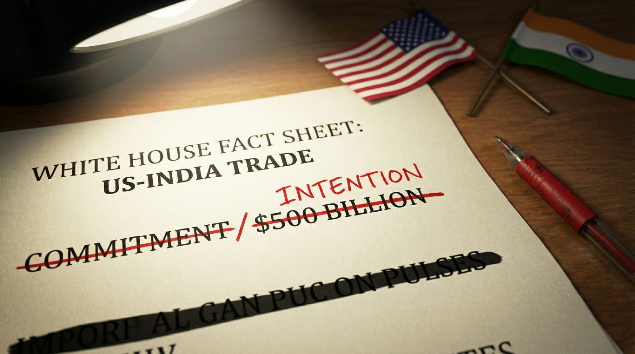
WASHINGTON: The White House has withdrawn an official Twitter graphic that depicted Pakistan-Occupied Kashmir and Aksai Chin as parts of India and revised its 9 February factsheet on the "historic" US-India trade deal, deleting references to pulses and converting a $500 billion purchase pledge into a non-binding intention.
The Geopolitical Reality
The episode is less about cartography than credibility. The deleted map had been hailed in Delhi as a diplomatic win; its removal signals that Washington will calibrate even symbolic positions when partners contest the packaging.
- 9 Feb: Original factsheet claimed India committed to buy "over $500 billion" in US energy and tech.
- 12 Feb: Reference to pulses disappeared.
- 13 Feb: Map tweet deleted; wording shifted to "India intends" rather than "commits".
"The revisions suggest the administration overstated concessions to impress a domestic audience."
— US trade-law blog
The View from Delhi
New Delhi could not allow a written assurance on import volumes that might box future governments; correcting the record preserves negotiating space. The map deletion is embarrassing but secondary—Brussels continues to use India’s official map in public documents, diluting any narrative loss.
Strategic Implications
Expect tighter scrutiny of every US read-out: if Washington edits hype on trade, security assurances may face similar walk-backs. For India, the lesson is to insist on joint texts rather than unilateral factsheets. For the US, the risk is that partners will price in a credibility discount when speed is valued over precision.